
Thanks to all who attended on April 21.
This event at Cashman Park was an opportunity learn about future sea level rise and its impact on one of our city’s parks.
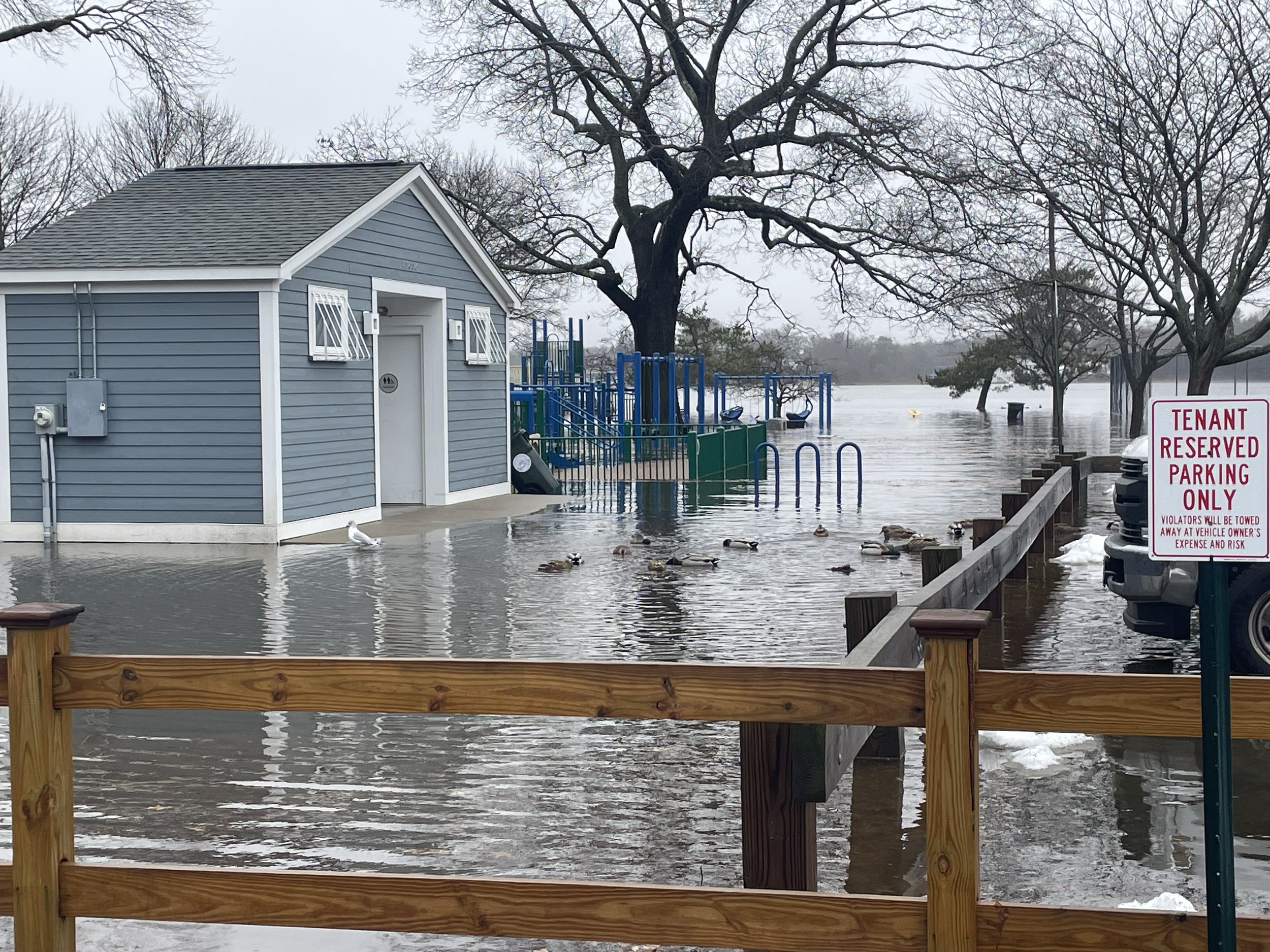
Cashman Park, Newburyport's largest and most used recreational hub and situated along the scenic Merrimack River, stands on the frontlines against the changing climate. Facing threats from rising sea levels, this event seeks to rally support for a climate adaptation strategy.
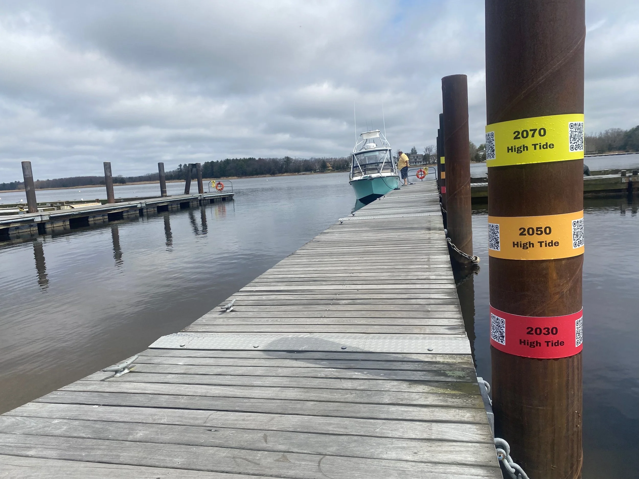
The colored bands on the boat launch pillars mark projected future high-tide levels in 2030, 2050, and 2070 based on the State of MA estimates. The ground markings, generated from the future high-tide projections and ground elevation measurements, vividly illustrate the encroaching high-tide waters' reach into the park. Please join all of us in thinking about and planning for the future of the park.

Why are sea levels rising?

This map shows regional trends in sea level, with arrows representing the direction and magnitude of change. (NOAA)Sea level is measured using tide gauges which are typically fixed at specific locations along coastlines. More recently satellites equipped with radar altimeters have been used. Mean sea level is the statistical average of sea level over time and is typically measured by coming tide gauge and satellite data.
Global sea level rise is primarily driven by two factors: thermal expansion of the ocean as it warms, and the melting of land-based ice, like glaciers and ice sheets. Over 90% of the heat from human-caused emissions is absorbed by the oceans, contributing to rising water levels. The extent of sea level rise depends largely on future emissions of heat-trapping greenhouse gases and resultant warming, while the speed of rise is influenced by the rate at which glaciers and ice sheets melt.
In Massachusetts, sea levels are expected to rise by between 0.6 to 1.2 feet above 2000 levels by 2030, and up to 4.2 feet by 2070. These are relative values, meaning you add this amount to the current mean sea level.
This rise, combined with increased precipitation, is likely to intensify the duration, intensity, and frequency of both tidal and storm-related flooding. Additionally, more frequent extreme weather events could lead to stronger and more frequent storm surges and coastal flooding.
In Newburyport, the implications of this rise are profound, particularly in low-lying, riverside areas like Cashman Park. The park, along with other nearby coastal and riverside regions, faces increased risks of flooding, erosion, and the potential for more severe storm surges. Current tides in Cashman Park are measured at a tide gauge near the Coast Guard station. Station ID: 8440466
History of water at Cashman Park
Mary Baker Eaton outlines the history of Cashman Park in her blog the History of Newburyport.
Named for former mayor Micheal Cashman, the park was built in 1922 on 18 acres of bog and marsh.

Rising Sea Levels

As sea level rises, twice daily high tides will inundate the park with water.
The Massachusetts Coastal Flood Risk Model is an interactive map that can show future flood projections for any address in the state.
The tide-markers on the pillars at the boat launch are aligned with the projected average high tides in future decades.
Predicting inland flooding
This model also contains estimates for Mean Higher High Water (MHHW) in future decades. MHHW average level of the highest tide for each day computed over a 19-year period.


These are mapped on the ground, by compare them to elevations to LiDAR topography of the park areas.
This map was created by Kirk Bosma, Woods Hole Group
Inundation is the amount of water that occurs above normally dry ground as a result of flooding. Inundation is most commonly referenced to the average daily highest tide, or Mean Higher High Water (MHHW) tidal datum. Inundation typically begins when water levels reach above this level.
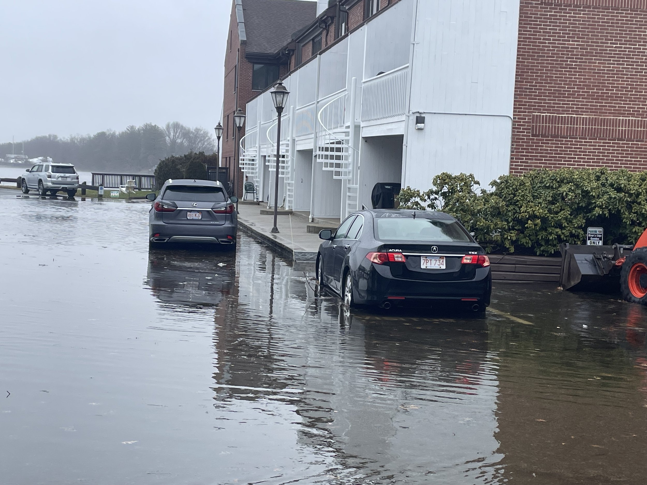
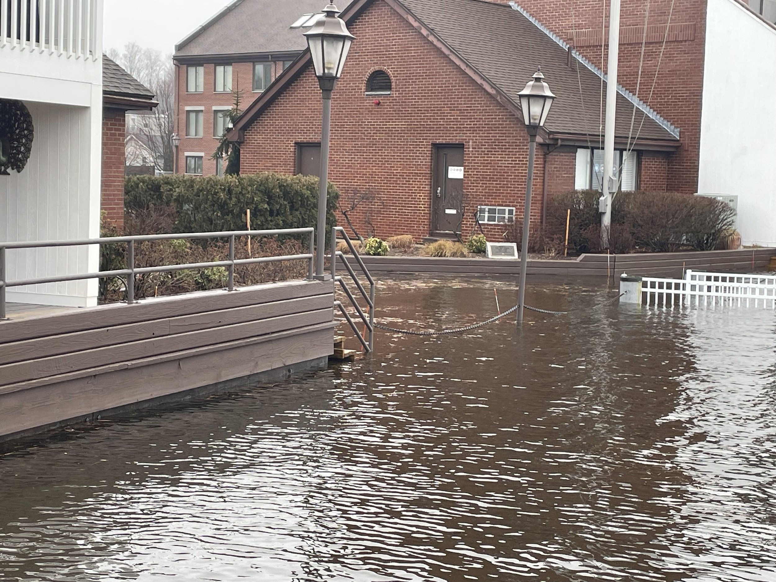
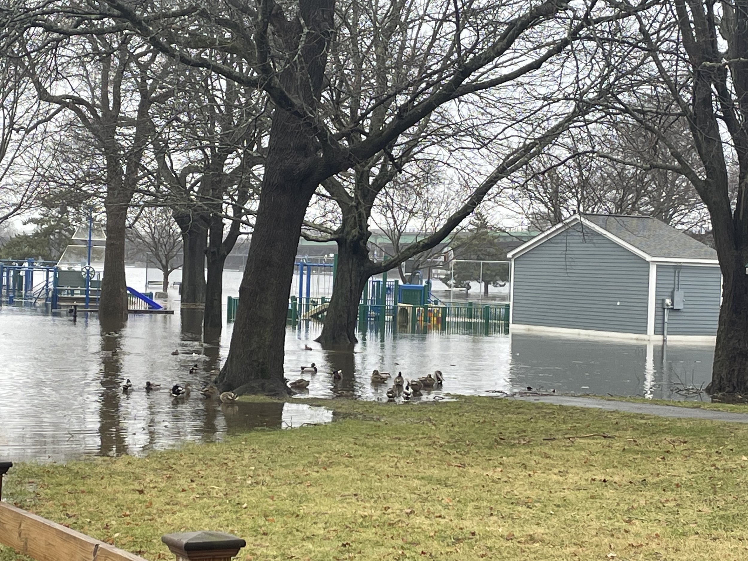
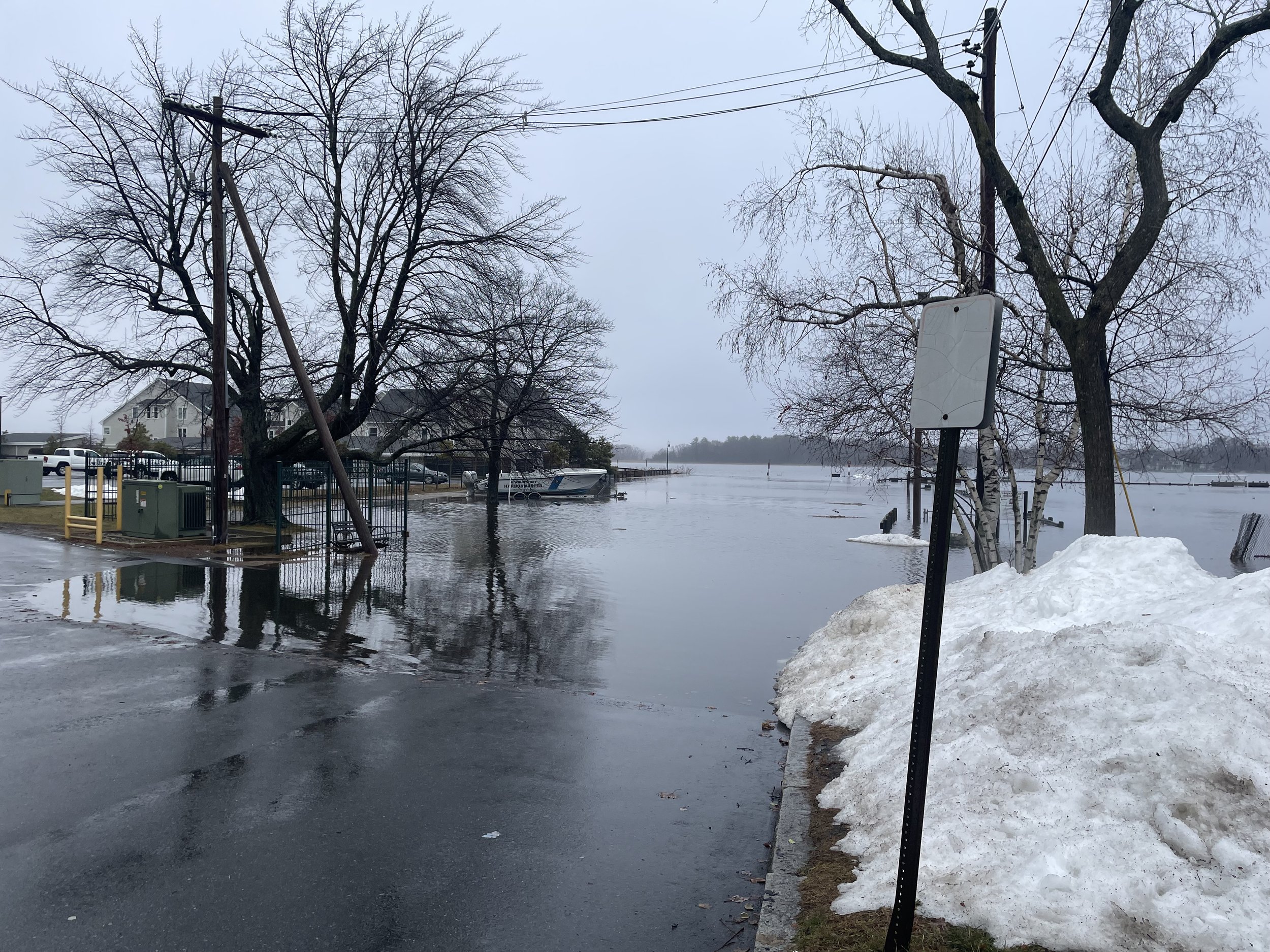
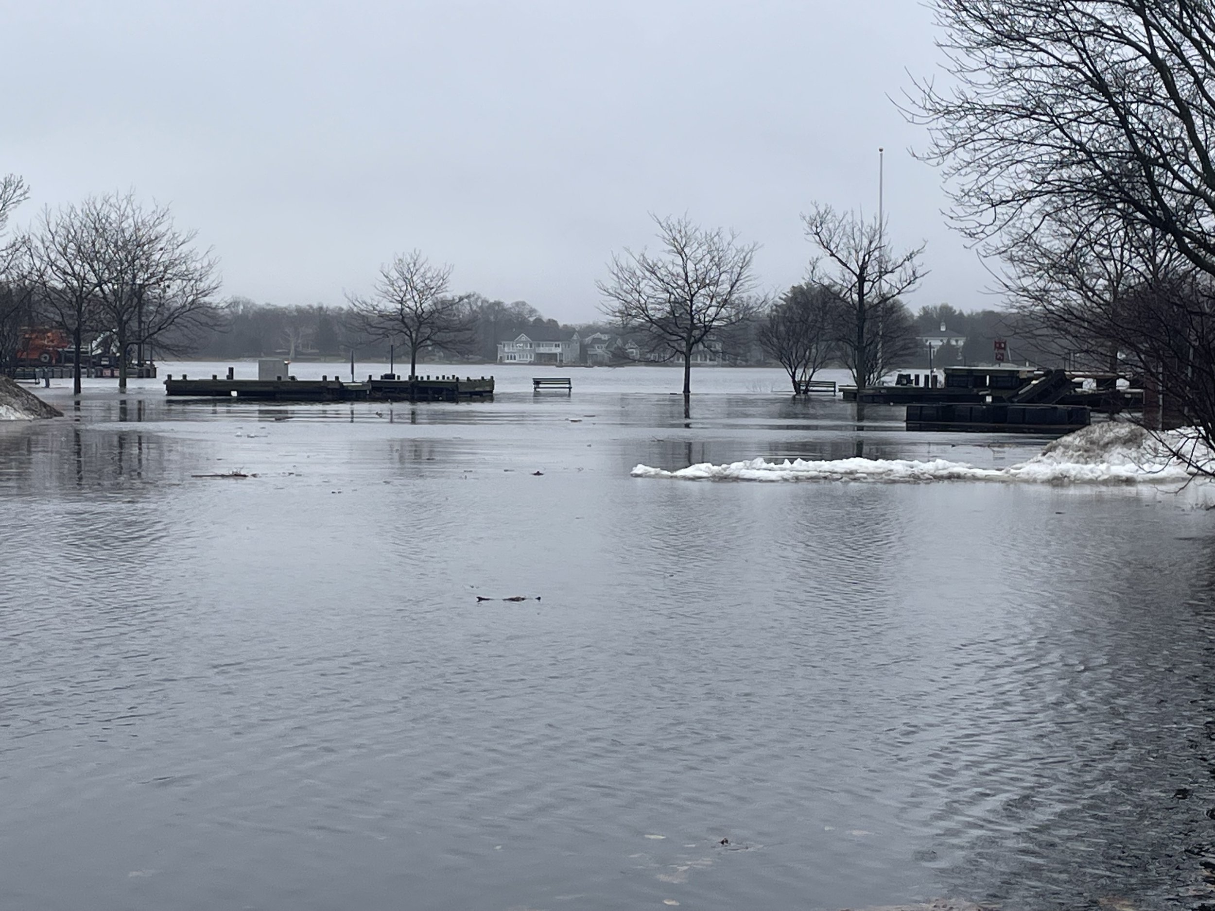
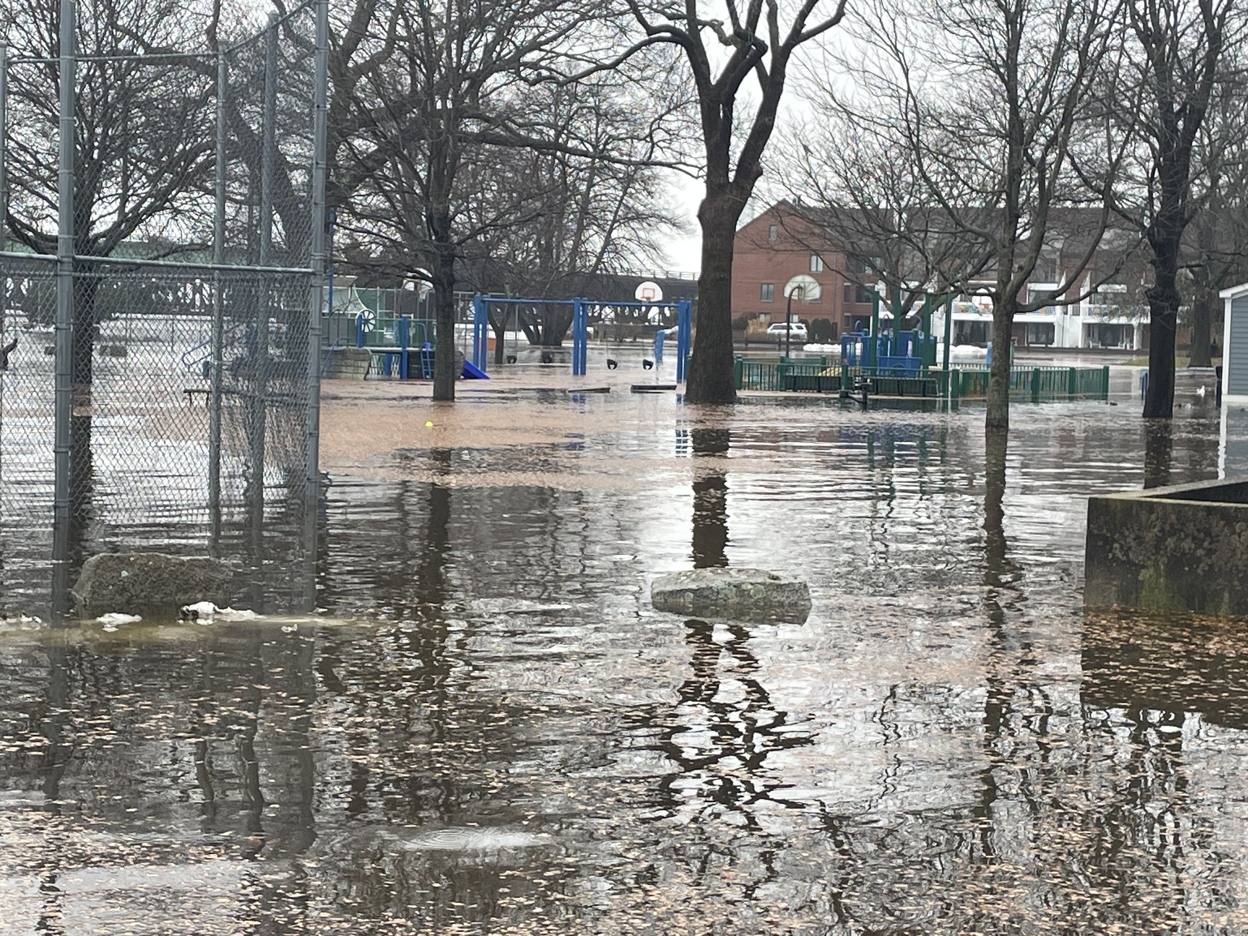
Current Storms can show us a preview of the future.
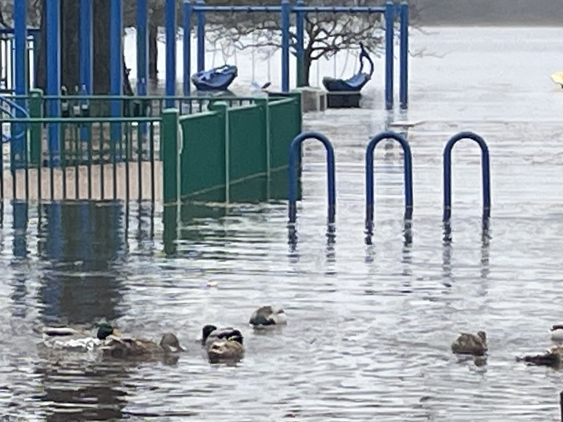
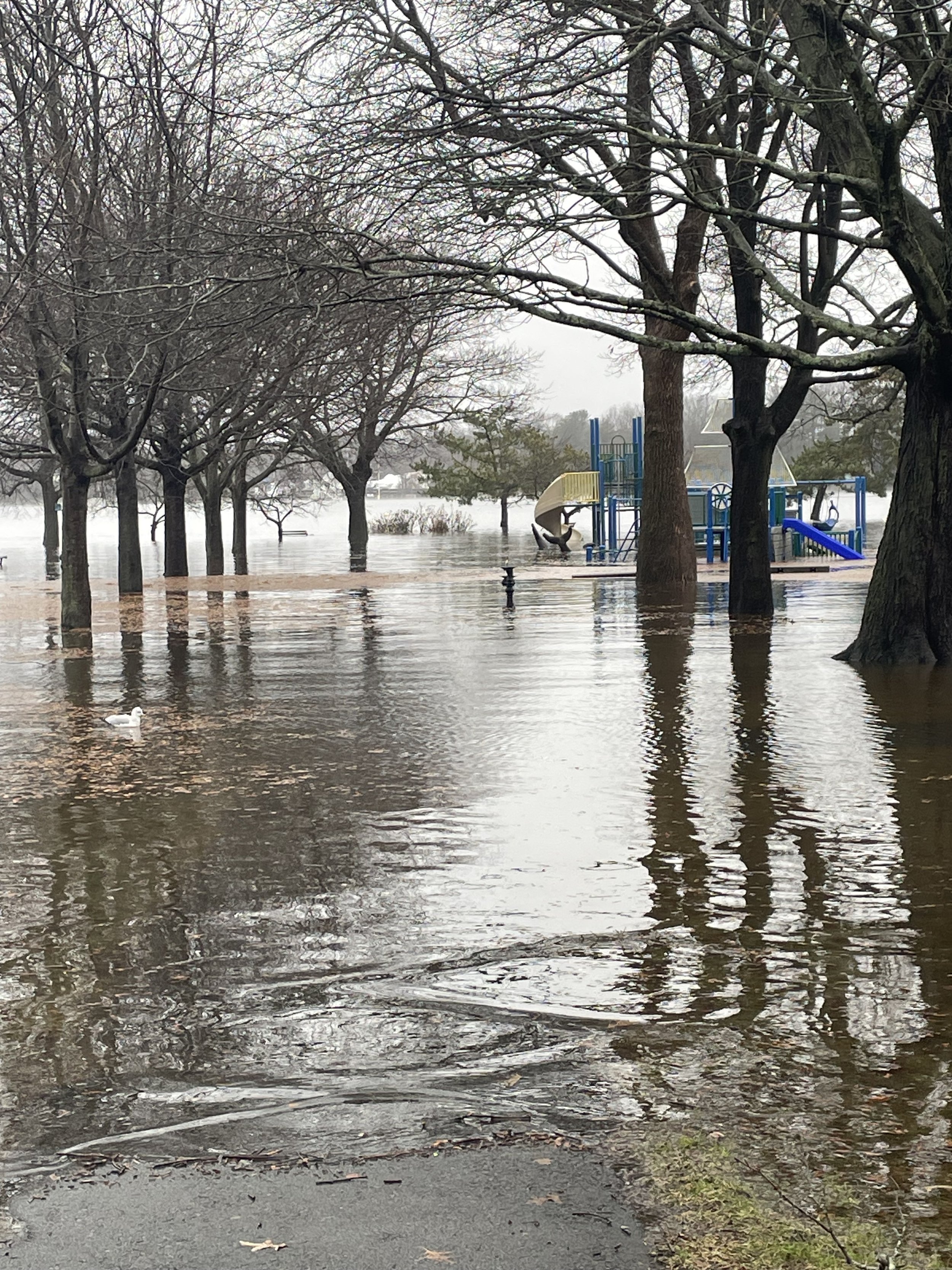
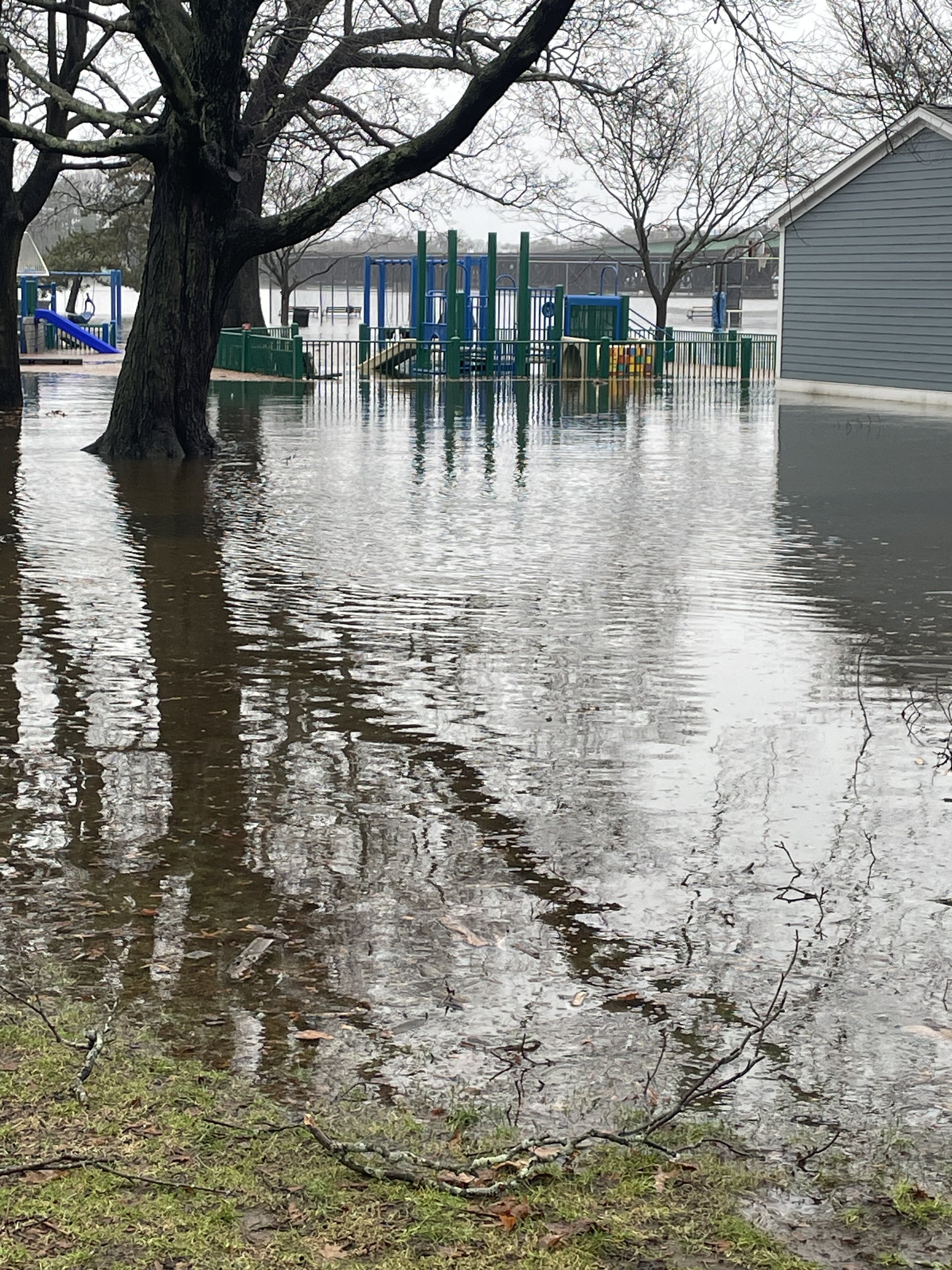
The storm on January 13, 2024 flooded Cashman Park to at least 2050 levels.
In the future this level of flooding is predicted to happen twice daily at the high tides.
According to Kyle Pederson, a meteorologist at the National Weather Service Boston office, the flooding on January 13 was a combination of astronomical tides and a strong low pressure system that brought a lot of rain. The low pressure causes sea levels to rise because there’s a lot of air pushed down on the sea. Along with the heavy rain and gusty winds, offshore waves were between 12 to 15 feet which also contributed to the high water levels in the region.
According to the Stone Living Lab, during this storm, the late morning high tide was the fourth highest water level ever recorded at the Boston NOAA Tide Gauge. At the Boston NOAA Tide Gauge, high tide peaked at 11:48 am at 14.41 feet Mean Lower Low Water (MLLW), which was over 3 feet higher and half an hour earlier than the predicted high tide level.


What can we do?
Think about what you’d like for the future of Cashman Park. Options include abandoning the space to future flooding or designing a new flood resilient park area. Redesigning the park to better withstand flooding will take time and investment.
Examples such as the Emerald Tutu prototype in Boston and other nature-based solutions are a good place to start. These floating mats would need to be arranged close to the shoreline away from the docks and boat ramp at Cashman Park. They could also be used downstream at Joppa and certain parts of the Plum Island Basin.
Resilient Boston Harbor is a comprehensive plan combining flood adapted buildings and nature-based solutions to protect Boston.
Salem has implemented a study of ways to protect their waterfront while prioritizing nature-based solutions.
Beverly is studying ways to protect Lynch Park.
Our city’s next steps should include a comprehensive plan for a Resilient Newburyport waterfront including Cashman Park.
Residents can also encourage the Parks Commission to develop a flood management plan and to retrofit and redesign Cashman Park for climate adaptation.
We are grateful…
This project could not have been completed without the support of the following groups and individuals.
Funding from the Institution for Savings
Graphics support by DUO and Megan Chiango
Technical Support from the Newburyport Resiliency Committee and in particular Jon-Eric White and Jane Healey
Technical and on-the ground support from Salem State University - Dr Stephen Young, Jason Risberg and members of the Salem State drone class and geography club
Woods Hole Group - Kirk Bosma
The City of Newburyport Parks Division Parks Commission and Harbor Master, Paul Hogg
Massachusetts Department of Fish and Game
The Rising Tides project is funded by a grant from the Institution for Savings


